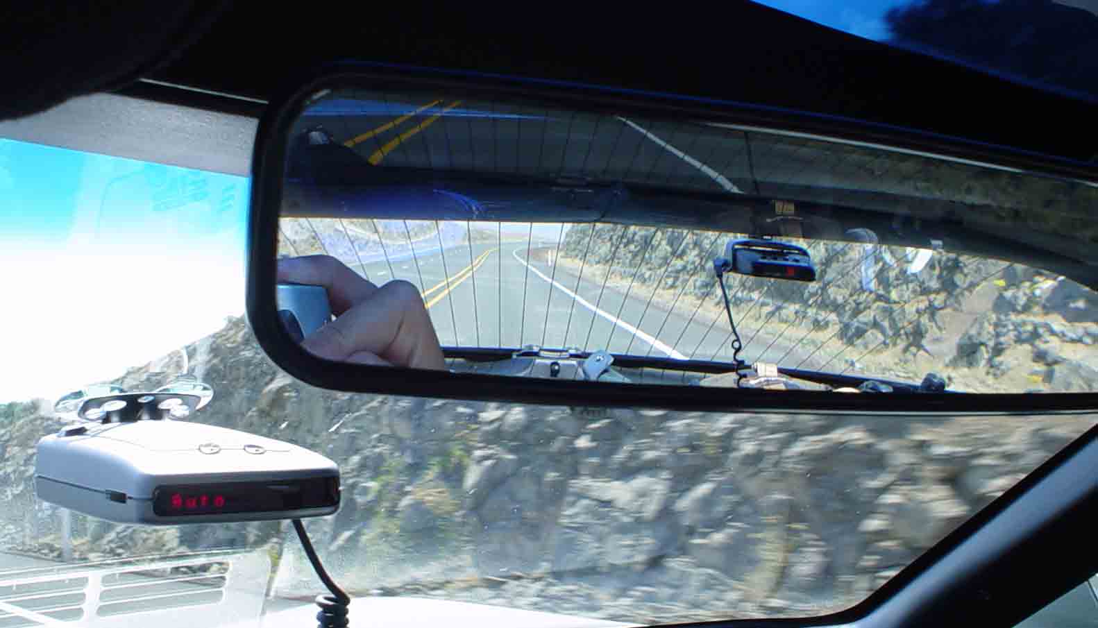
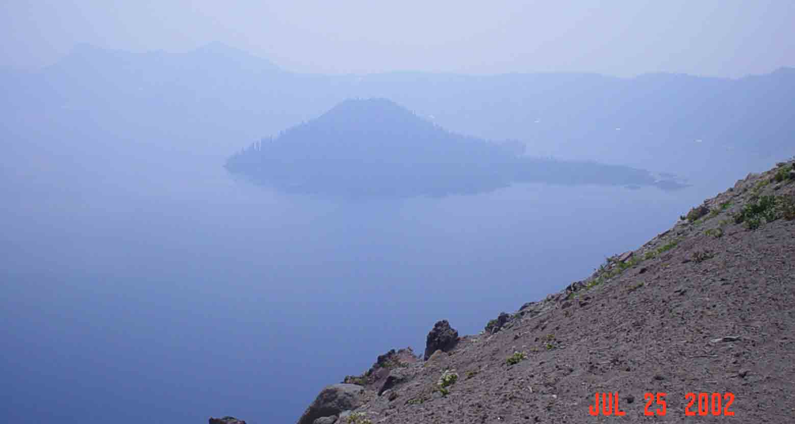
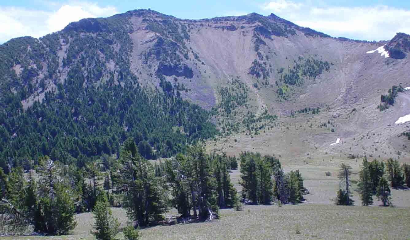
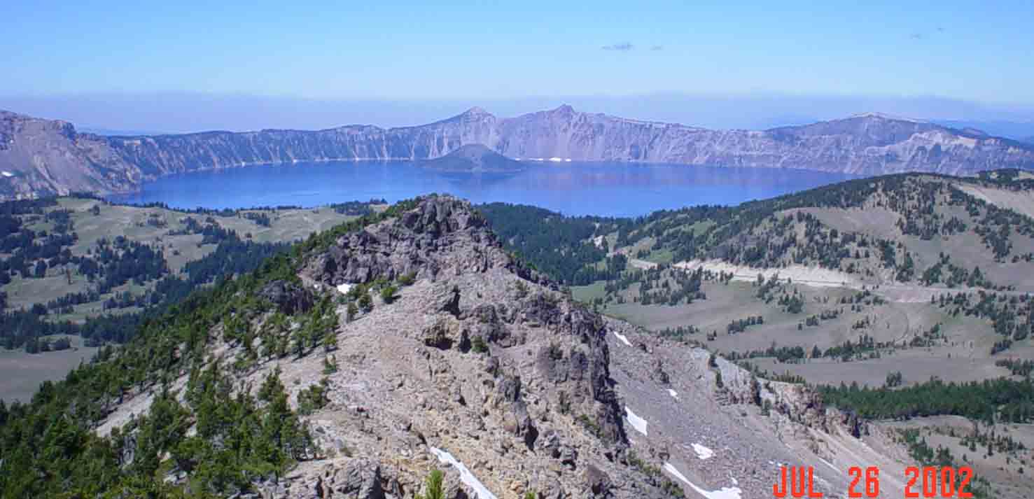
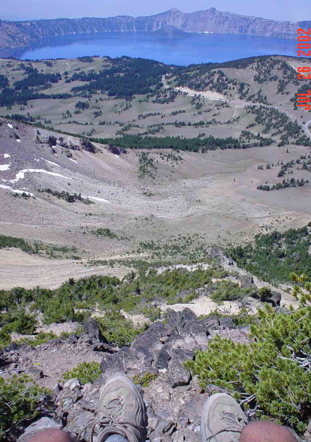
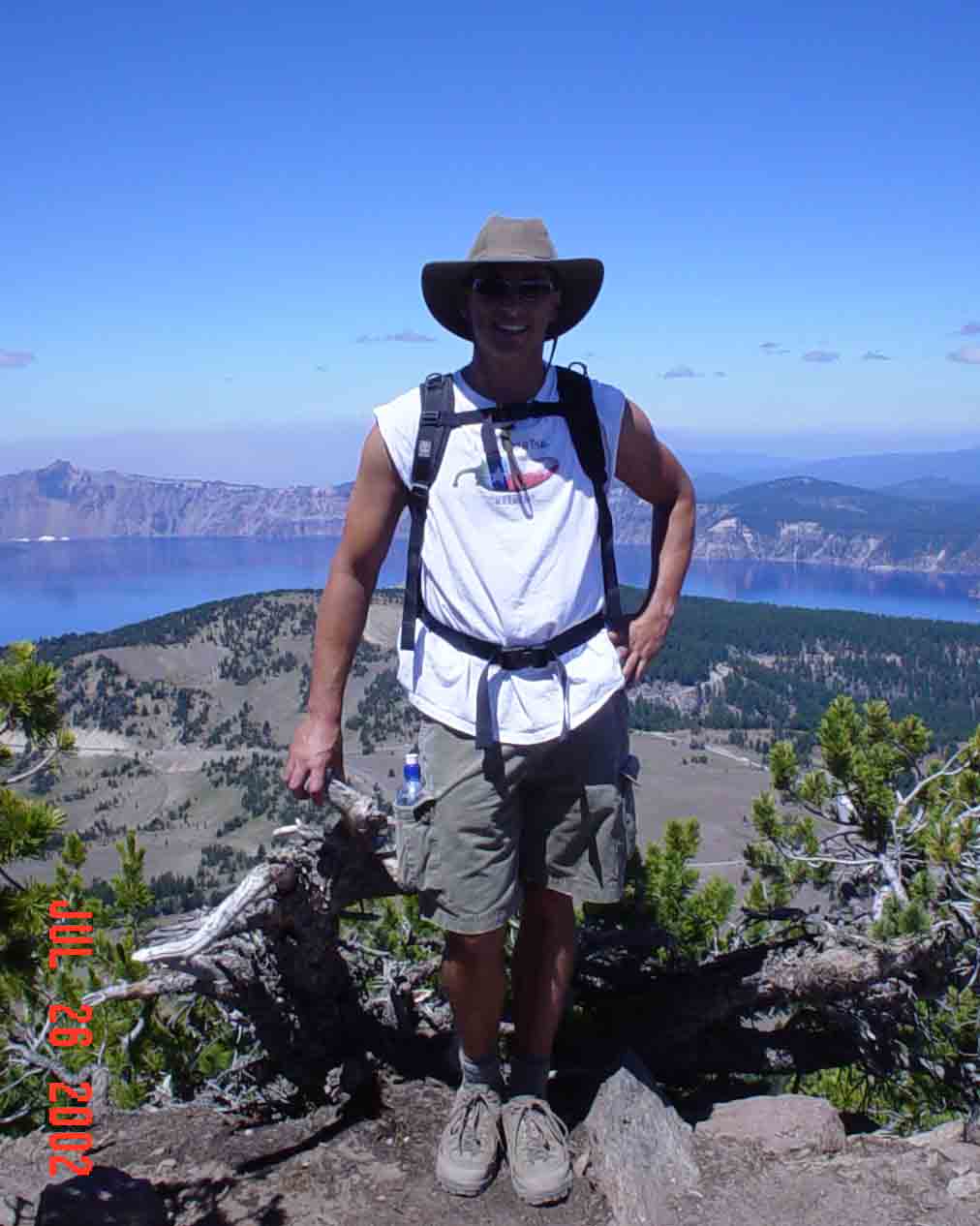
Ok, this isn't too conspicuous. I've purchased a much better radar detector. However, for added security, I've mounted the old radar detector to the back window where I can see it from the rear view mirror. My only other option at this point is to wait for the Cling-on cloaking device to come out on the market...or I guess I could slow down...nope, I'll hold out for the cloaking device. Welcome to Crater Lake National Park. Unfortunately, I can't seem to escape wild fires. Every single park I've visited has had some type of wild fire activity. Hear the amazing view is clouded by smoke from both from fires in the park and from other fires in Oregon. After securing some lodging for the night I got in a quick 2.2 mile hike down into the Caldera for a boat tour. This actually should be called Caldera Lake National Park. I quickly learned that if the area surrounding a volcanic eruption is greater than 1 mile across it's called a Caldera. If its less than 1 mile across it's called a Crater. The Caldera left by the eruption of Mt. Mazama almost 8,000 years ago is 6 miles across.  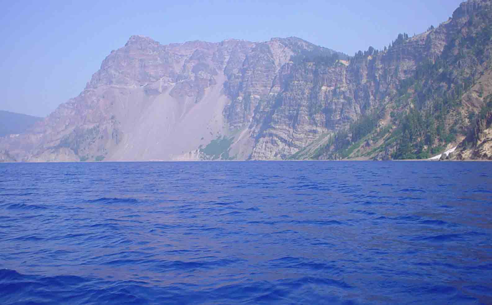 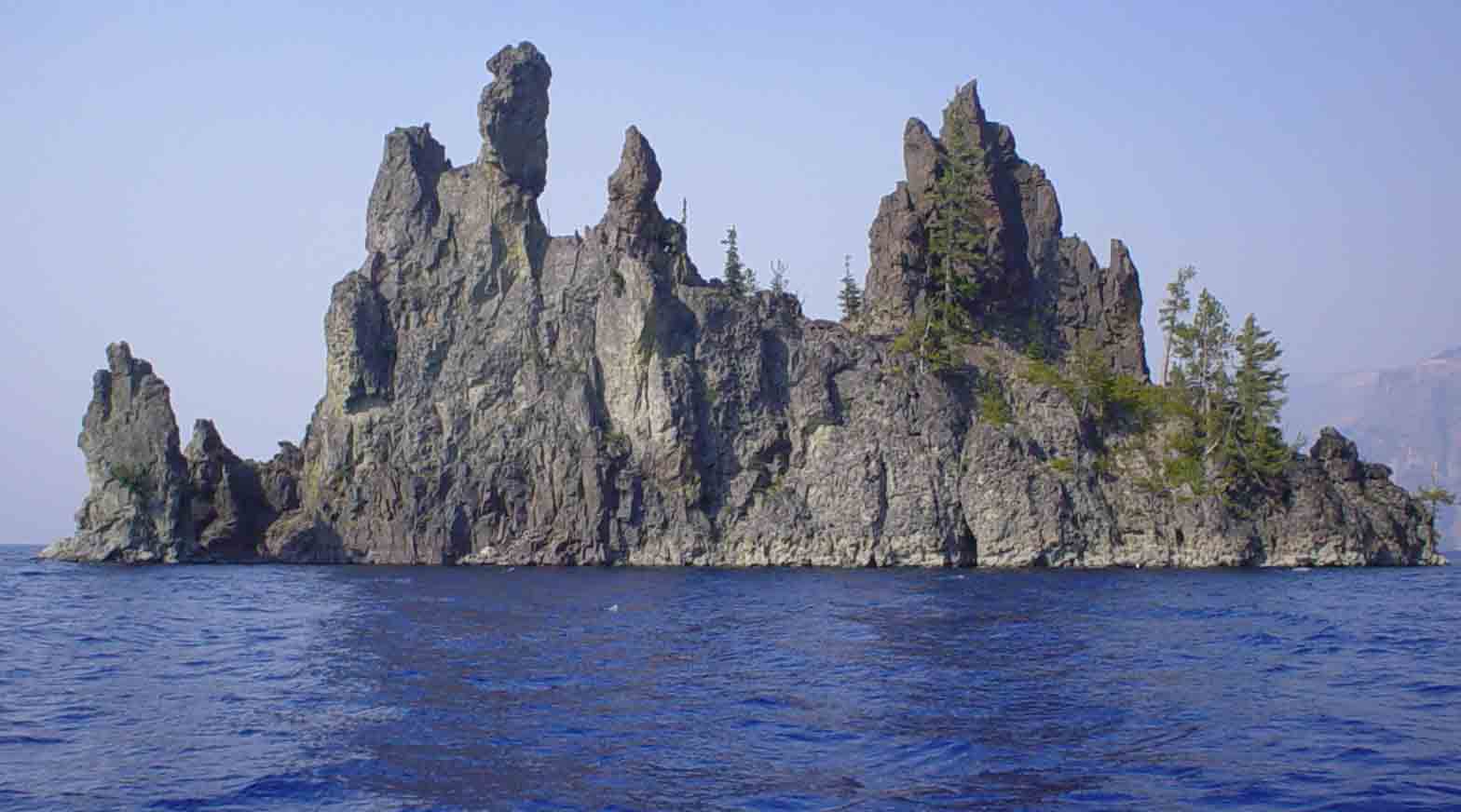 In a matter of 3-5 days Mt. Mazama went from over 12,000 feet to 6,000 feet after it erupted and then collapsed in on itself. Over a period of 800 years the Caldera filled with water from snow and rain. For that reason the water lacks any type of nutrients or organic matter that can support life. In the 20's the NPS stocked the lake with several species of fish, however, most died off. Today some trout and salmon live in the lake, but in very small numbers given the lack of food available. They say that the lake is now at equilibrium in that it gains(rain and snow) and loses (evaporation and leakage) about 30 billion gallons a year. The reason why it is so blue is because of the depth 1,900 feet and the lack of organic material in the water. The water absorbs Red and yellow light at the surface. However, blue penetrates very deeply into the lake and is then reflected back. This is what the human eye picks up which is why the lake looks deep blue.  This is just another shot of the smoke. It gets worse later in the afternoon. Hear you cant even make out the rim of the caldera. On my second day in Crater Lake I hike the largest summit in the park. It's called Mt. Scott and was once a volcano that now sits just outside Mt. Mazama's Caldera. The day was much clearer and the view of Crater Lake was outstanding. The little island you see in the middle is called Wizard Island and was formed by a little mini eruption thousands of years after Mt. Mazama erupted. The summit of Mt. Scott. Not a bad place to have lunch. Oddly at the summit I met three awesome people (a woman and her husband and sister). We chatted for about 45min about all sorts of stuff. The woman and her husband were full time RV'ers. Meaning they have no permanent home. They just travel in this monster mobile home all over the country. When they want to take a break they come back to Oregon (where they are from) and camp. The sister and her husband are retired also and living on the water about 35min North of L.A.. She actually offered to put me up for a few days when I was in the area. Had I not already had accomodations I would have taken her up on her offer. |